
Black Canyon of the Gunnison National Park
The Black Canyon of the Gunnison is not well known in the pantheon of Parks. Overshadowed in virtually every direction by “better options” and more popular Parks. Not to mention it’s hard to get to, and then even harder to get to the other side of the Park. But, once you’re there, wow is this a site to see?
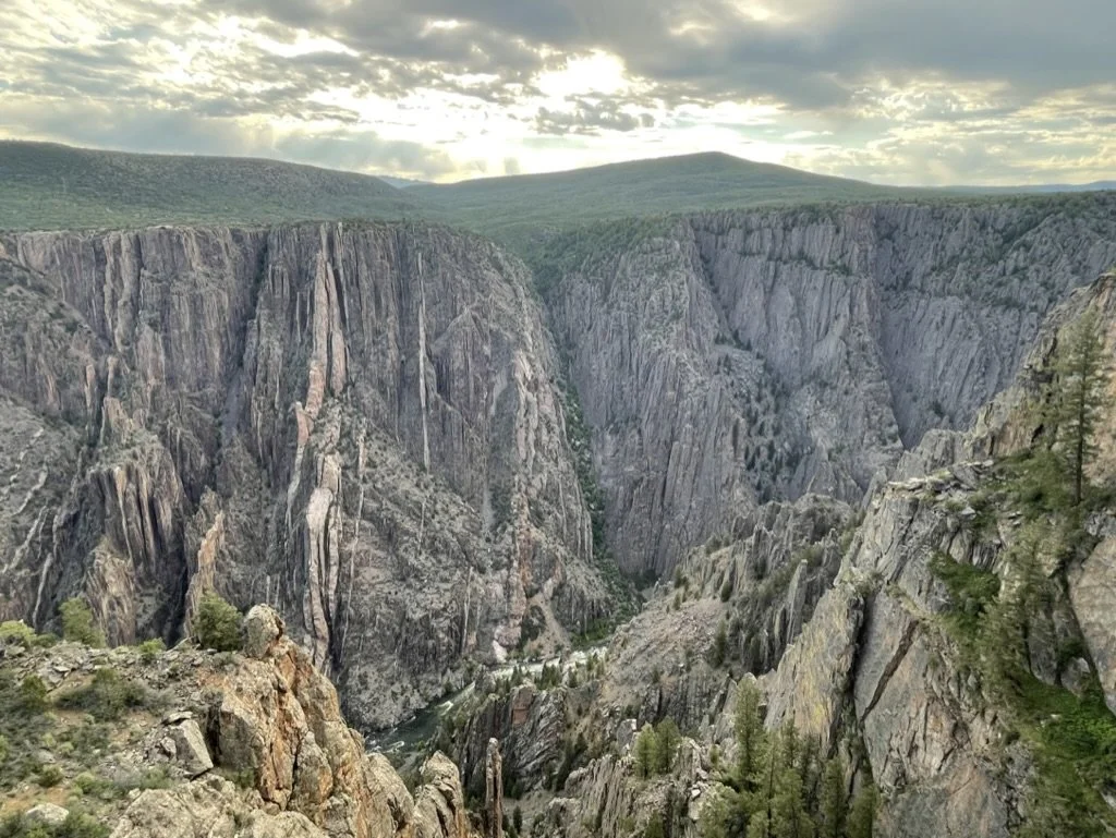
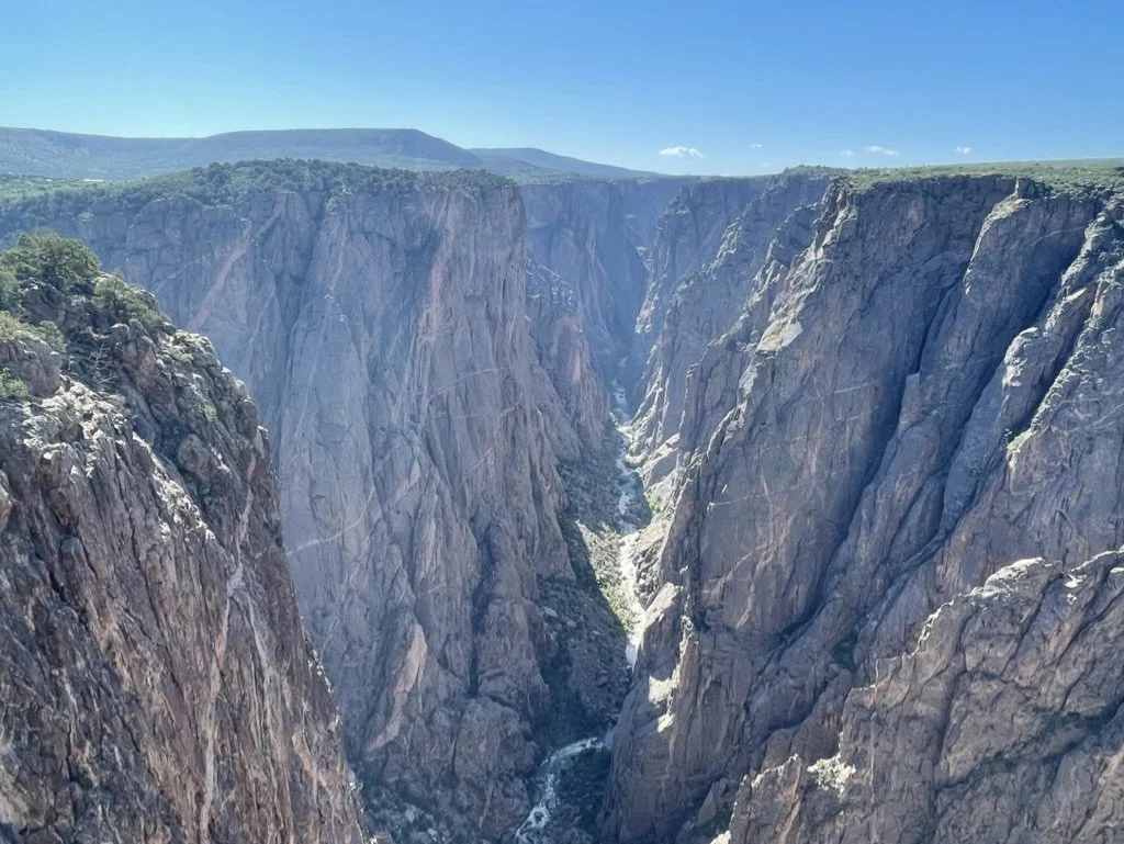
The Black Canyon of the Gunnison protects one of the steepest, narrowest, and most dramatic canyons in North America. Carved over millions of years by the Gunnison River, the canyon features walls that plunge over 2,000 feet and are so sheer that sunlight barely reaches the canyon floor—giving it the name “Black Canyon.” It was named a national monument in 1933 and elevated to a National Park in 1999.
Our route took us from Mesa Verde north to Telluride for lunch and then into Montrose of the night. Day one in on the South Rim was the 4th of July, and a great way to celebrate American Patriotism. The visitor center was not open when we arrived at 7am, but the getting there early meant we might have a chance to gain a permit to hike to the canyon floor.
There are three primary inner canyon hikes from the South Rim that take hikers to the Gunnison River. The Gunnison Route is the most popular, because it’s the easiest; it drops 1,800 feet over 1.5 miles. Tomichi Route is the shortest at 1 mile, but that makes it much steeper as it drops 1,960 feet in that distance. Then there is the Warner Route, which is the longest and most challenging as it takes 2.75 miles to decent 2722’. And in all three instances, if you can make it down these unmarked trails full of loose rocks and poison ivy, you still have to make the climb back up.
The Rangers are deadly serious about who can take these trails. They talk about how you should take photos of the trail as you come down, highlighting natural landmarks, so that you can find your way back up. All of the trails are considered back country trails and all require permits. On the South Rim, which is much more popular, in the summer, permits can be obtained beginning at 3:30pm the day prior, and they go fast for Gunnison and Tomichi. That’s why we ended up with Warner, because we arrived the morning of, and Gunnison was booked.
A note for families: this was an adult only hike, not kids. We think the girls could have made it. But it would have been their absolute maximum and it would have been slower.
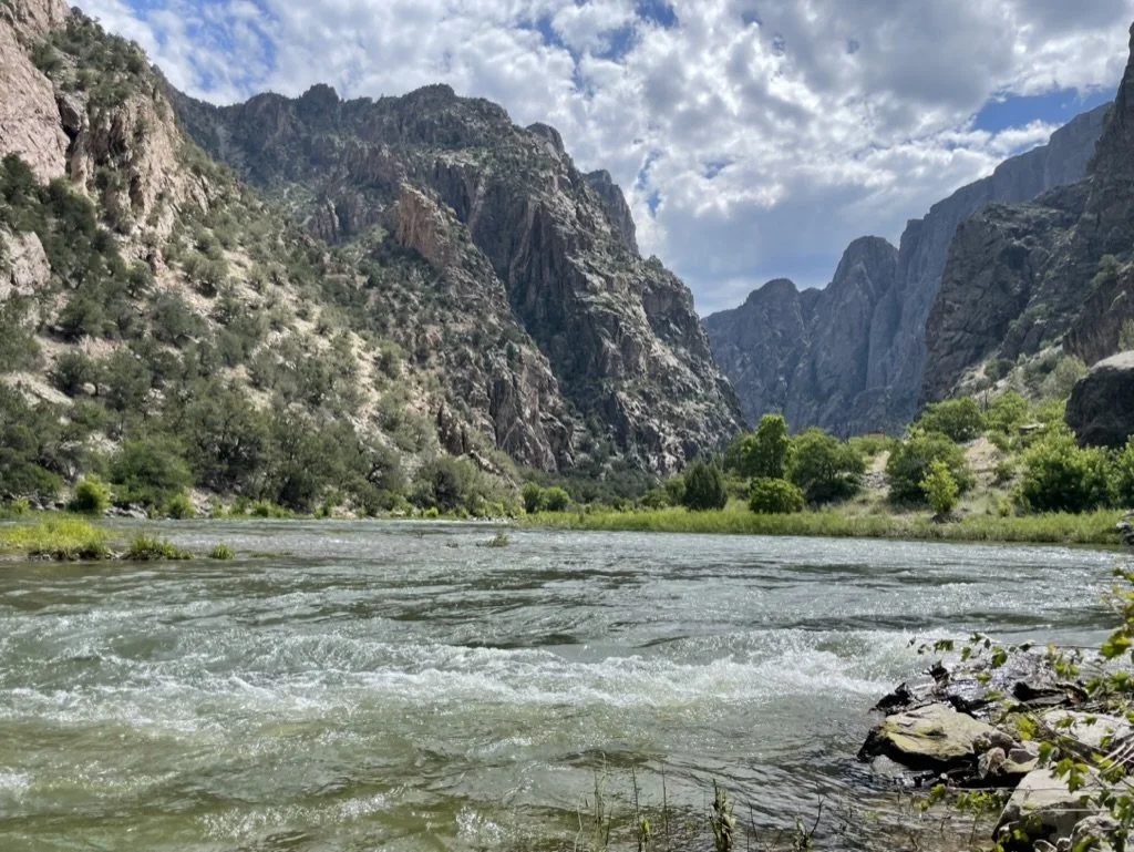
In all, Warner clocked in at six miles and 3000’ elevation loss and gain over six hours, including rest and exploration time at the bottom. This was a hard hike. This was a hot hike. This was a dangerous hike. This was a very rewarding, beautiful, unique, almost-bucket-list hike. For the entire route up and down, there was only one other group on the trail, a twosome who came down much later in the day.
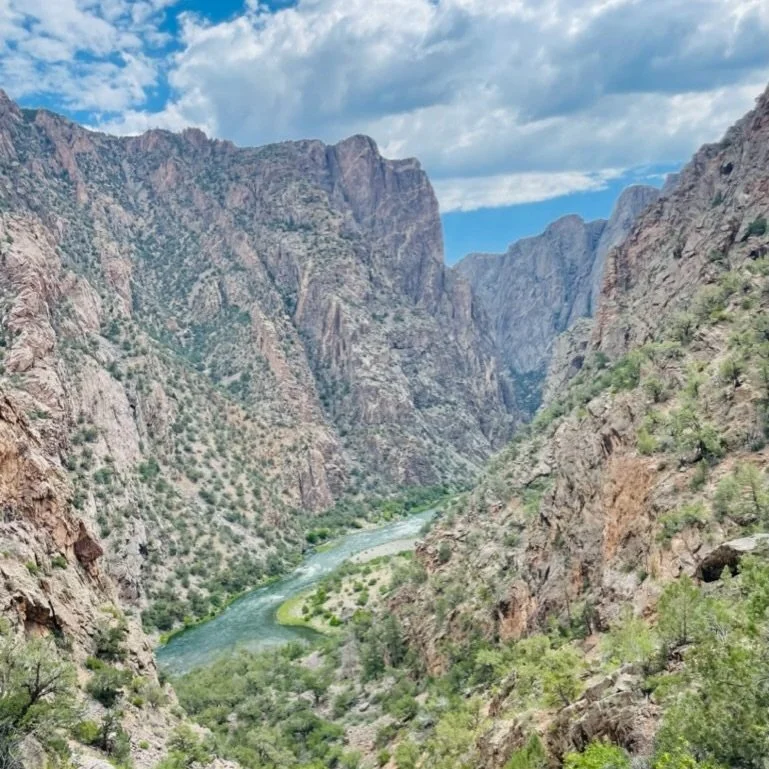
Black Canyon of the Gunnison is still amazing if you only gaze down into the canyon from the rim — and there are myriad overlooks on both rims. But if you have the ability to get all the way down, make the effort. But be prepared and take it seriously.
On the way back to camp, we hit up all of the great overlooks: Cedar Point, Painted Wall View, Gunnison Point, Pulpit Rock, etc. Even the view from the visitor center is epic. Overnight was at South Rim campground. and before we hit the sack, we enjoyed a ranger talk at the campground’s ampitheater.
The next day, began with a two-hour drive from the South Rim campground to the North Rim. The North Rim is much less popular, and was virtually empty the day we were there. The visitor center on that side was closed, but they had posted information on the trails.
We took the trail to Exclamation Point, which not only has an amazing name, but an apt one as well. This is the spot where you can essentially look straight down 2,500 feet to the river below. After the hike, we drove a handful of other lookouts, all just as amazing as the next. There are four additional rim-to-river routes on the North Rim, which do not require permits. They just require a self-service sign in. We’d done our big hike, so we moved on.
We were heading North, so we made our next stop at Grand Mesa. It’s worth noting that just an hour and a half north of Black Canyon of the Gunnison is Grand Mesa Scenic Byway (a state of Colorado designation) and Grand Mesa National Forrest. Neither is part of the National Parks System, but it is a part of the state worth visiting and spending some time in.
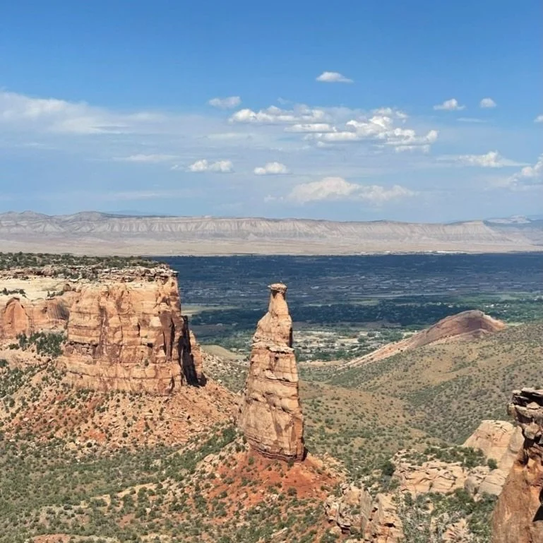
Unfortunately we just drove through. We also made the drive through Colorado National Monument just past Grand Junction, and we finally settled halfway across Utah at Maple Grove Campground (BLM) for the night.
Next stop, Great Basin.